OC Survey has created a GIS application that allows users to view historic aerial imagery throughout Orange County. This easy to use application contains imagery from hundreds of aerial surveys throughout the past 50+ years as well as Countywide imagery from various years including 1938, 1947, and 1952. This is an ongoing project and more imagery will be added in the future. Click on the image below to view:
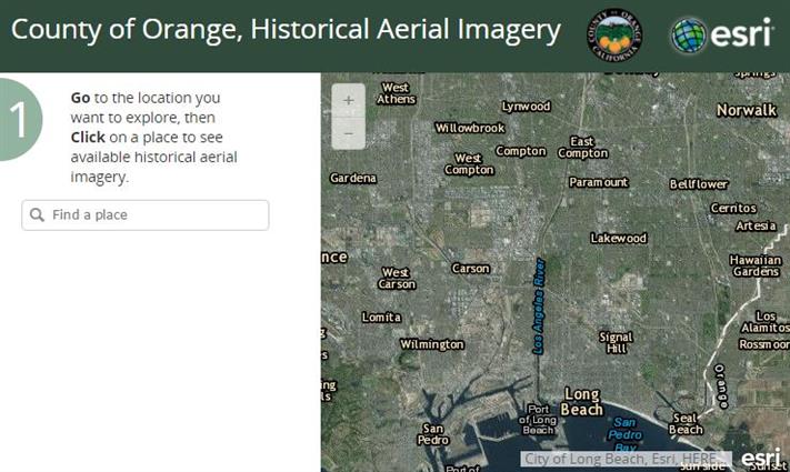
To use this application, zoom into your area of interest and select a location with your mouse. A Timeline bar will appear along the bottom.
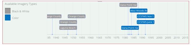
This bar displays the available imagery for this location. Simply select the desired tab and the image will overlay.
 |
|
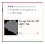
- You can control the transparency by using the slide bar on the left.
|
 |
|
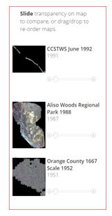
- You can load multiple images on top of each other as well as change the display order by selecting and moving up or down.
- To remove the image, move your mouse over the thumbnail on the left and select the X that appears in the top left corner.
|
Questions or comments?
Please send a message to OC Survey.